66246772

From Turnov to Kozákov hill
Come with us to climb the highest mountain of the Bohemian Paradise - Kozákov 744 m above sea level.
Length of the trail: 12 km
Trail description:
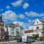
We begin our trip from the square in Turnov, following the red tourist trail through Skálova Street and Metelkovy sady to the local part of Záholice. Turnov lies at the crossroads of ancient trade routes. After 1620, the estate was acquired by Albrecht of Wallenstein. We now enter the area of the Klokočí Rocks. We continue along the red trail. After about 1 kilometre, we turn off to Zdenčina skála, offering a view over the Jizera Valley. We return to the junction and continue along the red trail, following the romantic path along the ridge of the rocks to the junction with the yellow trail.
Here, we can choose whether to continue along the red trail through the Klokočí rock passages or take the yellow trail, which leads to the ruins of the rock castle Rotštejn. From Rotštejn, we follow the blue trail to the Fialník crossroads, where we reconnect with the red-marked trail.
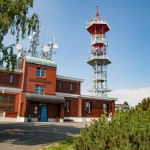
We then reach the village of Vesec, from where we begin the ascent to the highest mountain of Bohemian Paradise. On the slope of Kozákov lies a beautiful natural site called Měsíční údolí (Moon Valley). However, as it is not directly on the marked trail, it usually remains hidden from tourists’ view. We continue steeply uphill to an artificial rock cavity called Drábovna, which once served as a guard post. Now we face the final kilometre that separates us from the top of Kozákov. The magnificent panoramic view from the lookout tower and the refreshments at Rieger’s Chalet will surely be a worthy reward for the demanding ascent. For the return to Turnov, a tourist bus can be used.
The entire route is approximately 12 km long. Due to the demanding terrain, this trip is not recommended for children.